The view from Dam Protesters’ Point
November 20, 2015
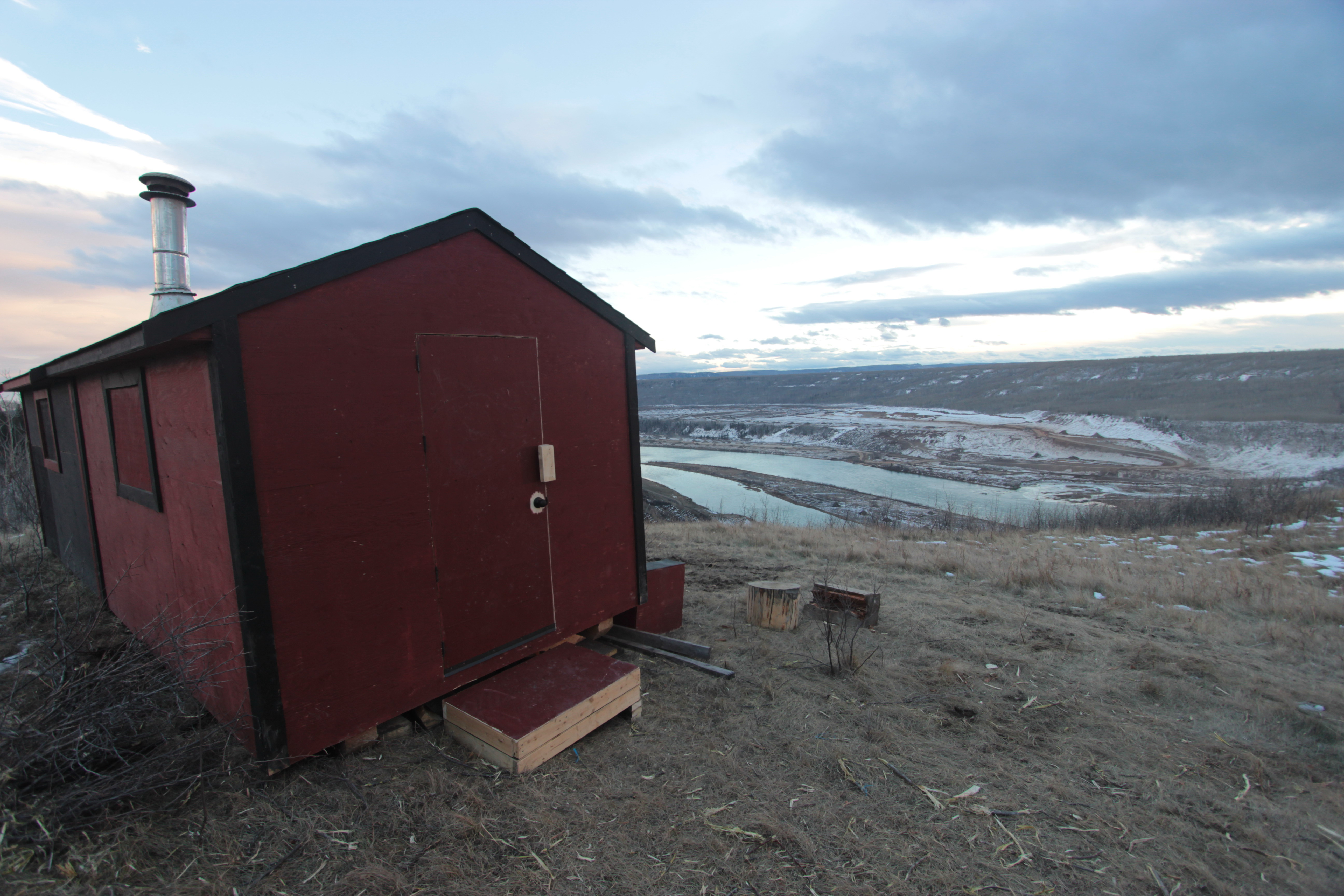
A flock of ravens were having fun riding the cold breeze on the ridgeline overlooking the Peace River. Here sits a red shack, perched on the edge of the grassy escarpment looking out over the valley, its windows focused like glassy eyes on the massive industrial site below.
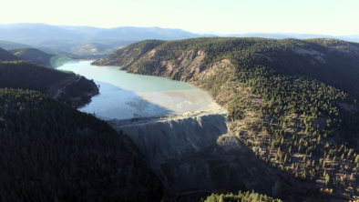
Last week, I joined about a dozen other environmental activists who had been invited here by local farmers and First Nations people to come and see “Dam Protesters’ Point,” as this observation shack had been named by my guides. It is located on the ridge across from the confluence of the Moberly and Peace Rivers. Below was the site of the proposed Site C dam, roughly 100 days since heavy equipment had begun tearing up the river and surrounding forests.
It was a sobering sight.
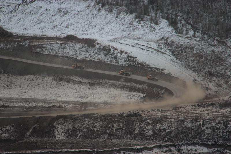
A line of huge trucks could be seen lumbering up the hillside. These were not the kind of trucks you’d see at a normal construction site, but more like the massive machines used at an open-pit mine. I could see excavators along the river and even in the river. Piles of logs lined the freshly constructed roads. Much of the ground was covered in wood chips from a forest of crushed and “mulched” old-growth trees.
“Wow – if this is what 100 days of work on the Site C dam looks like, I don’t want to see more. We have got to stop this terrible project,” I muttered.
But after speaking with some of the locals, the view got even worse. I was shown the full impact of the on-going destruction.
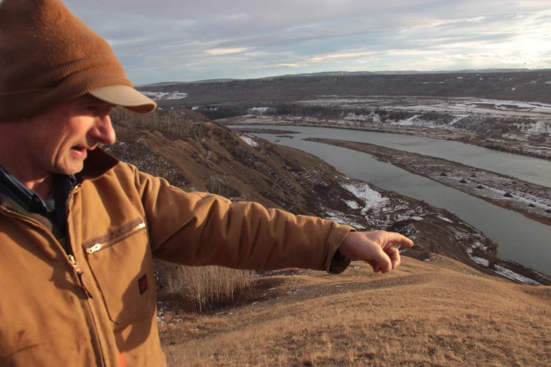 “See that forested flat over there?” asked Ken Boon, as he pointed across to an area the mulchers hadn’t reached yet. “That’s the site of Rocky Mountain House, the first non-Native settlement in BC. You can still see where the buildings stood in the late 1700s. It’s slated to be clearcut and mulched over the winter. The BC government plans to eventually drown it under the Site C reservoir.”
Ken and Arlene Boon work their third generation farm on the north bank of the Peace River at Bear Flats – a farm that would see a large portion under water if the Site C dam goes ahead. In fact, a whole lot of farmland would be put under water. The Site C dam would cause the greatest loss of farmland that BC’s Agricultural Land Reserve has ever faced.
My gaze was directed to a spot where a beaver lodge had been crushed into the mud, and where an eagle nest tree had been felled and then shredded. The fish and wildlife that First Nations people have relied on since time immemorial are being wiped off the landscape.
The West Moberly and Prophet River First Nations have been battling in court to save their territory – but the excavators, mulchers and huge trucks are relentlessly expanding the death zone.
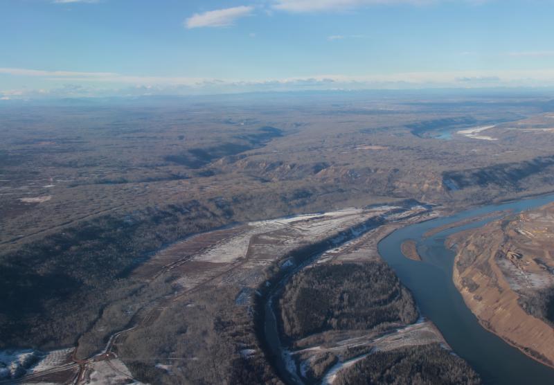 The scene of devastation on the Peace River was like a slap in the face. But it is a small scar compared to what the BC government plans to do. One hundred kilometres of valley bottom and riverside, with countless eagle trees, beaver lodges, historic sites and sacred places slated to be levelled, ground up and flooded.
As the sun slipped below the ridgeline, we left Dam Protesters’ Point determined to work together to stop this damn dam. It is a good and worthy fight. Please join us!
Joe Foy | National Campaign Director
Wilderness Committee