Canada's Tar Sands: Heavy Oil, Heavy Costs
Interspersed within the sprawling boreal forest of northern Alberta is a vast and intricate network of lakes, rivers and wetlands. This challenging landscape is home to the world’s largest industrial project: the tar sands or “oil sands”.
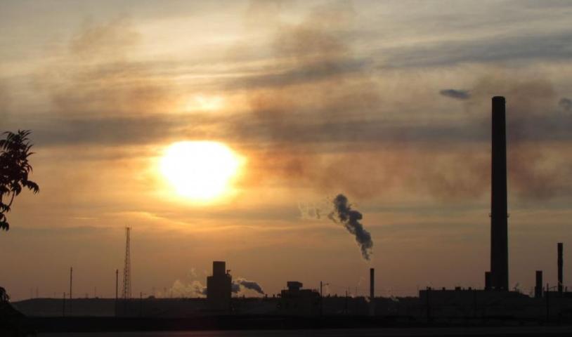
Here, the earth beneath the boreal contains a sticky, molasses-like product known as bitumen, which is being extracted and processed at an unprecedented rate to produce heavy crude oil.
The extraction process is incredibly energy-hungry, driving climate change and local air pollution. Tar sands production also uses an enormous amount of freshwater, much of which is drawn from the nearby Athabasca River watershed.
This poses a problem for the Peace-Athabasca Delta, the world’s largest boreal delta and one of North America’s most important nesting grounds for migratory birds. The region is also home to other wildlife such as bison, caribou, muskrat and moose, which help make up a traditional diet for the area’s First Nations communities.
Located north of the tar sands, the Peace-Athabasca Delta is considered to be at risk as massive industrial operations continue to reduce water flow and leak toxic pollution from tailings ponds.
Local First Nations have led the way in challenging the explosive expansion of the tar sands, and people from across Canada and the world are standing up to join them. To protect the remaining boreal forest and its wetlands, as well as community health and the global climate, most of the untapped tar sands reserves must stay in the ground.
Tar Sands Pipelines

Right now Canadians are facing an onslaught of fossil fuel projects as companies – particularly tar sands producers – work to get their products east and west to the coastline, or south to the United States.
From Enbridge Northern Gateway and Kinder Morgan's Trans Mountain project to TransCanada's Energy East pipeline and Keystone XL, keeping up with all the proposals can be overwhelming.
Map of Canada's Tar Sands
View Canada's Tar Sands in a larger map
Areas shown in red are existing tar sands extraction projects, while yellow indicates areas with tar sands extraction permits and/or leases. Note that the areas depicted on the map are at a fairly wide scale and may not be as accurate upon zooming in.