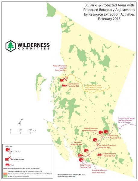
BC Parks Proposed Boundary Adjustments Map
Wednesday, May 27, 2015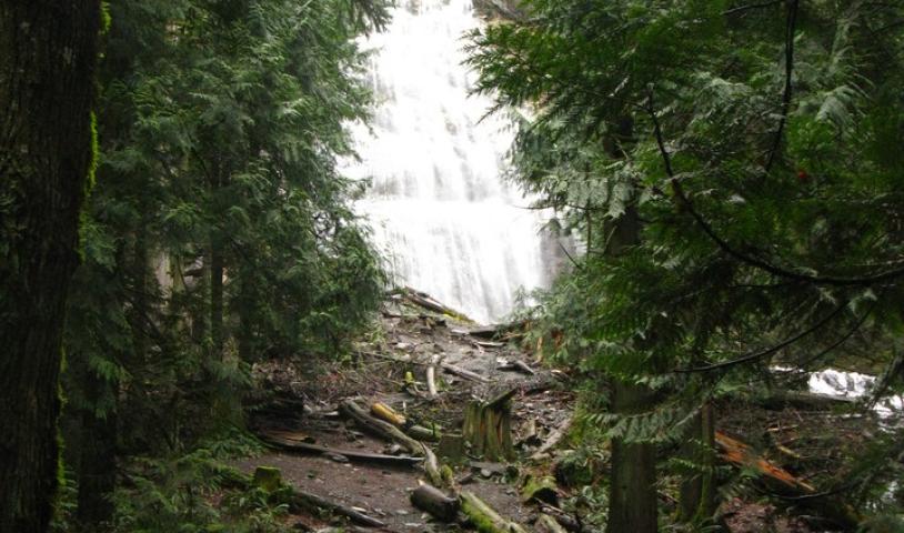
The Wilderness Committee has created a handy map to show visitors which provincial parks could have their boundaries adjusted to accommodate resource extraction. Right now oil and gas, logging and LNG companies are lining up to slice up BC’s parks. Pretty soon park visitors may have to picnic next to a logging road, or walk their dog along a pipeline route!
Currently, there are applications to adjust the boundaries of 8 provincial parks for industrial purposes including: Sasquatch Park (logging road) near Harrison Hot Springs, Kalamalka Park (road plus potential future utilities) near Vernon, and Bridal Veil Falls Park (Kinder Morgan pipeline) near Chilliwack –one of five parks and recreation areas that could have their boundaries adjusted for the pipeline proposal. The BC government has already approved removal of land from Nisga’a Memorial Lava Bed Park for a proposed natural gas line.
To view the map showing BC provincial park adjustments, click here.
WE NEED BC CITIZENS TO TAKE ACTION!
Monitoring our provincial parks is not a one person job – that's where you come in! We need boots on the ground to monitor our parks this summer. If you notice damage caused by industrial developments to any of the areas highlighted on the map, photograph and send your images to jennifer@wildernesscommittee.org. Please provide a brief description of where you took the photo, date and any other details (ie: approximate hectares affected by development, any noise/other pollution to nearby wildlife, etc).
Additionally, you can write a letter to BC’s Minister of Environment Mary Polak to demand that industrial activity be kept out of BC Parks.
BC Parks & Protected Areas with Proposed Boundary Adjustments by Resource Extraction Activities (updated February 2015)