Tyson IPP Causes Major Sedimentation Events in the Tzoonie River
Monday, May 10, 2010The Tzoonie River is one of the largest and most productive salmon and trout spawning rivers on the BC South Coast. It empties into the head of Narrows Inlet, about 35 kilometers northeast of Sechelt. The Tzoonie watershed and Narrows Inlet are within the territory of the shíshálh (Sechelt) First Nation.
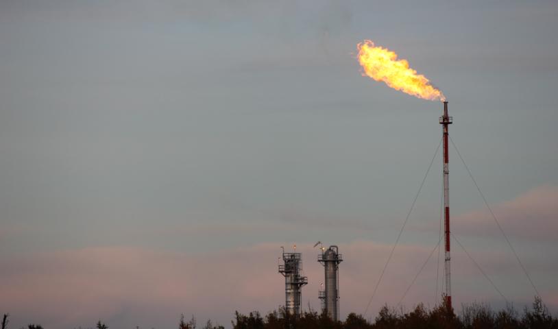
Tyson Creek is a tributary of the Tzoonie River. The confluence of the Tzoonie and Tyson Creek is salmon and trout spawning habitat. The adjacent reach of Tyson Creek is also fish bearing. Tyson Creek originates in Tyson Lake, a high elevation barren water body. The Tyson Creek independent hydropower project has been under construction over the last two years and became operational on January 22, 2010.
About the Tyson Creek IPP: This project uses Tyson Lake as a head pond. A tunnel, carrying the penstock pipe, was bored under the lake and a hole was blasted through the lake bottom to allow water to flow into the penstock and down to the generating station, after which the water is allowed to return to Tyson Creek, which has a fish bearing reach below the generating station. A re-watering pipe carries water from the tunnel back up to the creek’s natural outlet on Tyson Lake. This allows minimum flow requirements (5% of the mean annual flow) to be met.
First Problems:
It was noted during a December 5, 2009 site visit by SCCA Director Jason Herz that poor storm water management was resulting in avoidable sedimentation to Tyson Creek (see Tyson Creek Virtual Tour at www.thescca.ca). Ministry of Environment (MOE) staff subsequently inspected the Tyson Creek facility on February 17, 2010. MOE staff observed that sediment-laden water was being introduced by the project into Tyson Creek, and was apparently also impacting the Tzoonie River.
MOE staff contacted the proponent and project operations were halted on February 19th. Also, Department of Fisheries and Oceans staff determined that the project was not in compliance with approval conditions.
Remedial Requirements: More site visits took place and additional environmental assessments and studies were mandated. A new monitoring/operational protocol was established and approved by the MOE to ensure that operations would not have an unacceptably adverse environmental impact.
More Problems:
Sometime in March the Tyson Creek facility restarted operations. On March 21, 2010, several parties observed a plume of turquoise-colored water extending from the Tzoonie River estuary down Narrows Inlet for approximately one kilometer. Narrows Inlet waters are typical clear in late winter and springtime. Enquiries to project personnel revealed that Tyson Lake had been pumped down 30 feet from the lake’s natural level. Subsequently a large, previously sub-surface glacial-fluvial deposit collapsed into Tyson Lake. There were no automatic turbidity meters in place at the time and consequently the penstock delivered a large volume of water containing suspended glacial fluvial sediments into the fish bearing portion of Tyson Creek and from there into the Tzoonie River, its estuary and out into Narrows Inlet. Observers reported the turquoise plume to authorities and the project was again shut down.
The re-watering pipe continued pumping turbid waters onto Tyson Creek in order to meet the legal requirement to maintain minimum flows. After the project was shut down, there was apparently no visible sign of turbid water reaching the Tzoonie River from Tyson Lake. Tests showed that the glacial-fluvial sediments now suspended in the lake are very fine and will not settle out quickly.
Salmon in the Tzoonie River: Historically, the Tzoonie River supported large runs of all Pacific salmon species as well Steelhead, Dolly Varden and Cutthroat Trout (both resident and sea-run subspecies). Chum are the only remaining large salmon run in the Tzoonie River, numbering over 40,000 individuals in a peak year. Chum fry emerge from the spawning beds in March and immediately migrate down stream and out into the inlet.
Fisheries Act:
The federal Fisheries Act protects fish and fish habitat. Section 35 of the Act states:
“no person shall do any work that results in the harmful alteration, disruption or destruction of fisheries habitat” [unless authorized].
Also, Section 36 of the Act protects fish habitat from pollution: “No person shall deposit or permit the deposit of a deleterious substance of any type in water frequented by fish or in any place … [where it] … may enter such water…”
The Act allows for a “HADD” (harmful alteration, disturbance or destruction of fish habitat), if such is properly authorized. Usually compensation in the form of habitat restoration or enhancement is required in order to secure an authorization to alter, disturb or cause destruction to fish habitat.
Application of the Fisheries Act at Tyson Creek: Project proponents were required to and did obtain HADD authorization for unavoidable impacts to fish habitat prior to initiating construction of facilities. However, this authorization did not anticipate a sedimentation event of the scale observed on February 17 and March 21 2010, at the head of Narrows Inlet. Consequently, it appears that contraventions of Section 35 and 36 of the Fisheries Act have occurred.
A contravention of the Act does not necessarily result in the laying of charges. The proponent may attempt to negotiate a compensation package with remedial measures. If this approach is accepted, charges may be avoided.
Nature of the Event:
An interagency group of federal and provincial authorities has convened three times, including once on-site, to consider the nature of the event and possible solutions. The proponent and its consultants maintain that the March 21 flush of glacial-fluvial sediments did not disturb or harm fish or fish habitat and is mostly an aesthetic issue. It might be reasonably assumed that a sedimentation event of sufficient size to change normally clear waters in Narrows Inlet turquoise-green is more than an aesthetic issue. In our opinion, it is also reasonable to conclude that a concentrated sediment discharge from the project, at the time of fry emergence, did occur and that this was a harmful alteration and/or disturbance to the emerging fry.
Design Flaws:
The sedimentation event in Tyson Lake illustrates several significant flaws in the design of the project. Once a lake level has been drawn down, minimum flow levels in the out-flow creek cannot be maintained without operation of a rewatering pipe. In the event that sediment in the lake is mobilized, the options are to satisfy minimum flow requirements with sediment laden turbid water or to breach the minimum flow requirements. Either option is likely to be considered a breach of the Fisheries Act (unless such has been specifically authorized under the Act).
A larger issue involves the failure to design into the project constant turbidity monitoring and automatic shutdown capacity. When the sediment delta slumped into the drawn down lake, the Tyson facility proceeded to draw silt/sediment laden water through the generating station, into Tyson Creek, from there to Tzoonie River, out into the estuary and down Narrows Inlet. The sediment in this case is very fine and did not settle into the gravel beds from which young fry were emerging. Some fine silt is expected in a natural wild river. However, the Tzoonie River watershed is already in a compromised condition as a result of the cumulative effects of extensive and poorly regulated logging between 1970 and 1990. Any major sediment/siltation event will have a degrading and stressful impact on already precarious fisheries values. In our opinion, there can be no doubt that this event did cause a harmful alteration and/or disturbance of fish habitat.
Environmental Assessment Failures:
The Tyson project is too small to have triggered a formal assessment process through the BC Environmental Assessment Office. However, roughly the same number of permits and approvals are required with or without a formal BCEAO process. In this case, it appears that the application vetting process did not include significant bathymetric evaluation or study of sediment mobilization potential. In other words, the lake bottom and side-walls were not adequately assessed for stability or potential to slide, despite enormous fisheries values immediately downstream. As well, there was little or no attention paid to identifying silt and sediment deposits within the 50-foot draw down profile. Currently, Tyson Lake is still turbid in appearance. How long it may take for the lake’s clarity to be restored is not known.
Implications:
Currently the project’s biologists are suggesting that the “sediment mobilization” in Tyson Lake is a “unique” situation even though major sediment contamination of the Tzoonie River occurred twice in less than 3 months of operation. It could well be that this facility cannot operate without provoking sediment mobilizing events on a regular basis. That this could happen strongly implies that government’s environmental assessment of the project was insufficient and did not protect critical
environmental assets.
Drilling into the bottom of a high elevation lake to create a more reliable water supply is a very common design feature of many currently proposed run-of-the-river projects in BC. Other examples include Ramona Lake (Narrows Inlet), Phantom Lake (Salmon Inlet) and unnamed lakes above Vancouver Bay (Jervis Inlet).
It should be apparent that the approval process for projects involving lake-bottom drilling needs to be much more rigorous. We hope that the Tyson Hydro project outcomes will be thoroughly studied with the goal of ensuring that environmental assessment is sufficient to recognize and prevent similar potential sediment mobilizing events in the dozens of other projects that are proposing bottom drilling of high elevation lakes.
Daniel Bouman, Executive Director, SCCA